


Kanecountyconnects.com
Heavy rain, widespread tree damage, and flooding were the key impacts of the severe storms that swept through Kane County, toppling trees, knocking out power, blocking roads and damaging buildings.


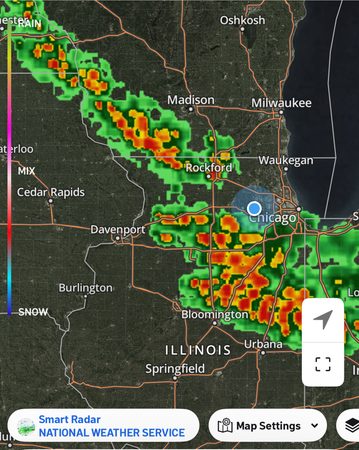
According to the National Weather Service in Chicago, hot and humid conditions developed on August 16 across northern Illinois, with heat indices between 100 and 105°F. This unstable air fueled nearly 17 continuous hours of thunderstorms from the afternoon of August 16 into the morning of August 17. On August 18, Kane County was placed under a tornado warning for a time impacting the northern portion of the county. Flooding also was reported following a series of storms that swept through the area on the 18th. (at this writing, updated rain totals from the NWS were unavailable.
The first round of storms on the afternoon of the 16th produced large hail and damaging winds, with the most severe impacts near Belvidere, Cary, Sugar Grove, Palatine, and Romeoville, where gusts likely exceeded 70 mph. Portions of Aurora also experienced significant wind damage, primarily from downed trees and power lines.
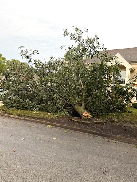
During the early morning hours of August 17, another round of storms brought torrential rain, flash flooding, and additional wind damage across western and southwestern parts of the Chicago metro area. A swath of 60–70 mph winds stretched from Algonquin to St. John, Indiana, between 2:00 and 3:30 a.m.—an unusually late hour for severe weather.
Rainfall totals over the 24-hour period from August 16–17 included 5.66 inches in Sugar Grove and 4.94 inches in Montgomery.
Wind damage of varying degrees was also reported in Carpentersville, Sleepy Hollow, Pingree Grove, Lily Lake, Elgin, Maple Park, Elburn, Kaneville, Sugar Grove, North Aurora, and Montgomery.
The Kane County Office of Emergency Management began collecting reports of significant uninsured structural damage to determine if the county qualified for a disaster declaration. Residents with major uninsured damage—beyond downed trees or cosmetic issues—were asked to submit a report through this form: https://laserfiche.kanecountyil.gov/Forms/Tornado-Response.