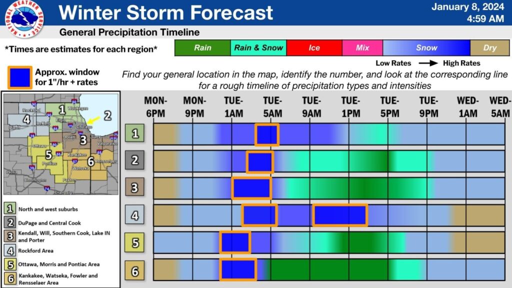
According to the National Weather Service, the Fox Valley is likely to experiece 2″-5″ of snow accumulation overnight Monday, with the heaviest snowfall coming just as the Tuesday morning commute begins.
On the positive side, it appears that the Fox Valley will be spared a heavy “Round 2” that is expected to involve even higher rates of snowfall Tuesday afternoon. The greatest impact of this wave will be to the west and north, including Dekalb County and the Rockford area.
The chart below, from National Weather Service Chicago, displays the latest estimation of the impact of the storm by region.

Note that the effects of this storm have the potential to reach well south of I88 and extend to NW Indiana. Caution is urged when travelling during this period.


