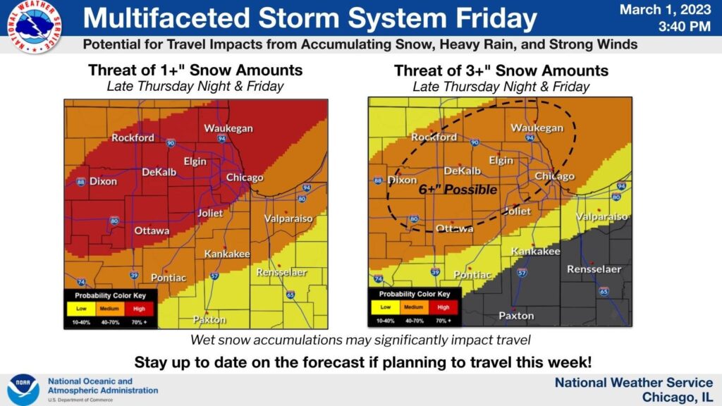
A large weather system is expected to enter the Fox Valley areas sometime Thursday evening, bringing cooler temperatures and the potential for heavy accumulations of snow.
The National Weather Service is confident that the region will get at least an inch of snow Thursday late into Friday, along with heavy winds, but that’s pretty much where there the certainty ends.
Because the storm track appears so unpredictable, the NWS is having a difficult time forecasting the important questions of “where” and “how much” with any certainty.

The two graphics above illustrate the wide variability of snow estimates, ranging from just an inch to 6+ in the core area. But as the track of the storm hasn’t solidified, it would seem to be anyone’s guess.
What we do know with certainty is that there will be significant precipitation coupled with high winds (45mph) beginning overnight and extending into Friday. Beyond that? We’ll just have to wait and see,


